Service

Soil investigation & site investigation in Egypt

Intrusive ground investigation across Egypt — rotary boreholes, undisturbed sampling, in-situ testing and groundwater monitoring, logged by geologists and reported to ASTM and BS standards.

Overview

Soil Investigation at a glance

Horema delivers multi-site ground investigation programmes for national infrastructure, coastal developments and major industrial works. Since 1980, our rotary rig fleet has supported the depths and geographical reach demanded by transit alignments, ports, towers and heavy plant foundations, with field data coordinated for the design teams responsible for each package.

Every campaign is scoped around the structures it serves rather than a standard borehole grid. Depth, spacing, sampling intervals and in-situ test frequency are set against the loads, the founding options under consideration and the ground conditions encountered as drilling progresses — because a campaign that cannot adapt to what the first boreholes reveal produces a report that designers cannot rely on.

Samples move from the borehole into Horema's own laboratories, which removes the handover delays and custody gaps that degrade undisturbed sample quality. Logging, testing and reporting sit under one accountable chain from field to deliverable.

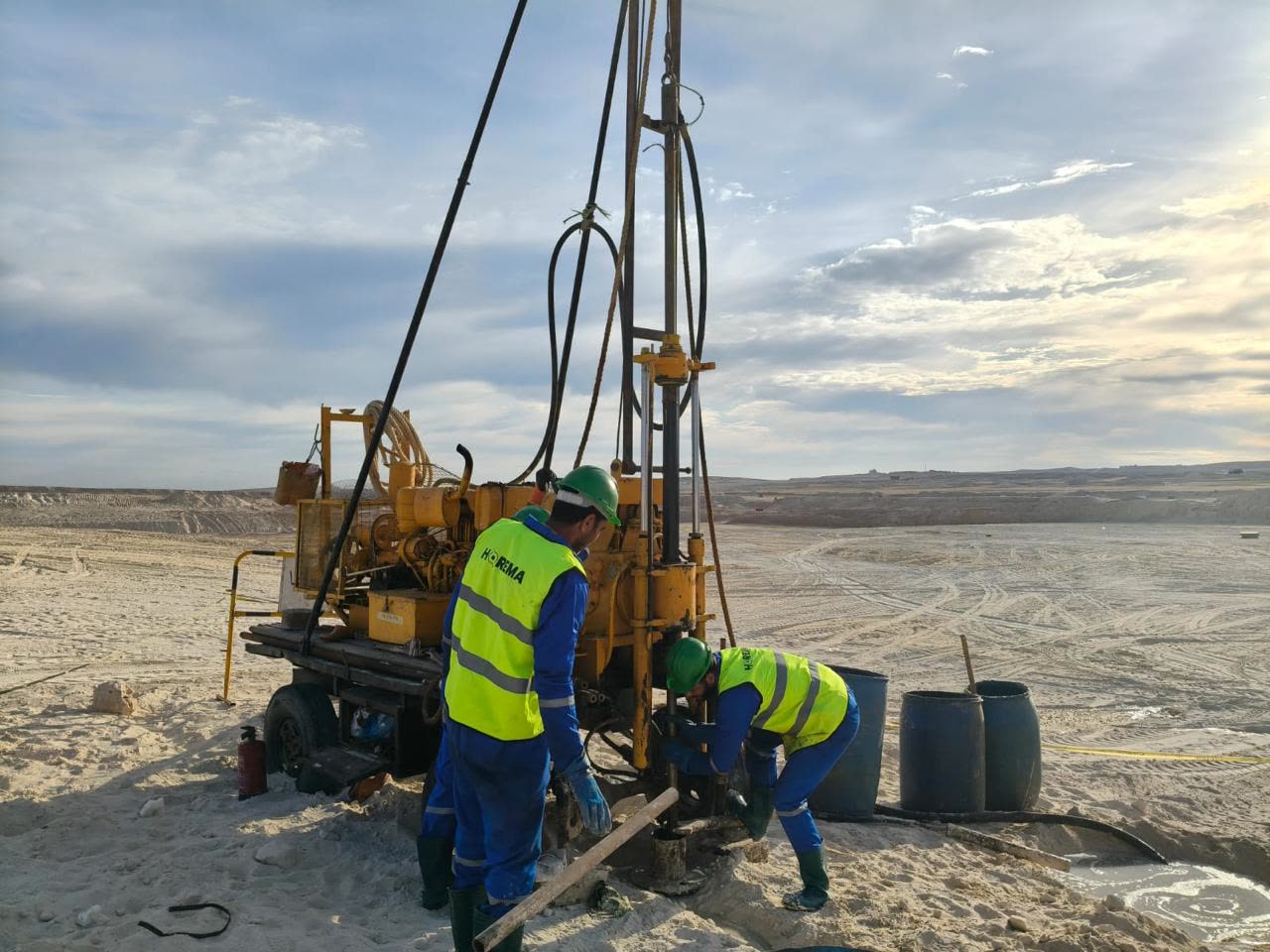
Horema rotary drilling rig and crew carrying out borehole soil investigation on an Egyptian site

Methods & standards

Test methods and the standards they follow

Rotary & percussion borehole drilling

ASTM D2113 · ASTM D1452 · BS 5930

Cased and uncased boreholes advanced through sands, clays, cemented horizons and rock, with core recovery and RQD logging where rock is encountered. Depth capacity extends to the deep boreholes required by high-rise, marine and canal works.

Standard Penetration Test (SPT)

ASTM D1586 · BS EN ISO 22476-3

Blow counts recorded at standard intervals to derive relative density, consistency and correlated strength and stiffness parameters. Hammer energy and rod length effects are accounted for so N-values are usable in design correlations rather than reported raw.

Undisturbed & disturbed sampling

ASTM D1587 (Shelby tube) · ASTM D3550

Thin-walled tube sampling in cohesive soils for strength and consolidation testing, split-spoon and bulk sampling for classification. Samples are sealed, labelled and transported to preserve moisture content and structure.

Field vane shear test

ASTM D2573

Undrained shear strength measured in place in soft to firm cohesive soils — essential in Delta and coastal deposits where tube sampling disturbance would otherwise mask the true strength profile.

Borehole permeability testing

ASTM D4050 · falling and constant head

In-situ hydraulic conductivity for dewatering design, seepage assessment and infiltration studies, run in the borehole at the horizon that governs the works.

Groundwater monitoring & piezometers

ASTM D4750 · standpipe and pneumatic installations

Standpipe and piezometer installation with repeat readings over time, capturing seasonal variation, tidal response on coastal sites and the fresh/saline interface that drives durability and buoyancy design.

Geotechnical logging

BS 5930 · ASTM D2488 · USCS classification

Strata logged by geologists to a consistent descriptive scheme, so logs from different rigs and different sites remain directly comparable across a programme.


Where it applies

Typical applications

  • High-rise and mixed-use towers on coastal and desert sites
  • Bridges, viaducts and transit alignments
  • Ports, quay walls, breakwaters and reclamation platforms
  • Industrial, power and petrochemical plant foundations
  • National housing programmes at multi-site scale
  • Water, sewer and pumping station structures sensitive to buoyancy

What you receive

Deliverables

  • Borehole location plan with coordinates and levels
  • Individual borehole logs with strata descriptions, SPT profile and sample register
  • Groundwater records including standpipe and piezometer readings
  • Laboratory test schedule and results appendix
  • Factual report, and interpretative report with foundation recommendations where instructed
  • Digital data in AGS format on request

Common questions

What engineers ask us about soil investigation

How is investigation depth set for major infrastructure works?

Depth is scoped against the foundation concept, expected loads and ground model for each structure or corridor section, with sufficient penetration below anticipated pile toes or other founding levels. Where soft deposits, karstic horizons or variable rock are encountered, the programme is reviewed with the design team and extended as the evidence requires.

How are boreholes distributed across a multi-site programme?

The layout follows ground variability, structural sensitivity and the design stage. Alignments, reclamation areas and individual critical foundations require different investigation densities. We scope positions against the project's packages and coordinate changes with the consultant as the first boreholes refine the ground model.

Which standards does Horema work to?

Field and laboratory work follows ASTM and British Standards, including ASTM D1586 for SPT, ASTM D1587 for undisturbed sampling, ASTM D2573 for field vane shear and BS 5930 for site investigation practice and soil description.

How long does a soil investigation take?

Programme depends on borehole count, depth and site access. For scale: the Million Housing Units programme comprised 539 boreholes totalling 5,554 metres across three governorates, with field work, laboratory testing and foundation recommendations delivered inside six weeks by running multiple rig crews concurrently.

Where we have done it

Related project experience

Need soil investigation on your site?

Send us the site location, the structures planned and your programme — our team will scope the investigation and testing required.

Request a scope