

Our services
Field, lab and everything between
Horema offers a comprehensive suite of geotechnical and field engineering services designed to support infrastructure, marine, industrial and urban development projects across Egypt.
Soil Investigation
Borehole drilling, sampling, in-situ testing (SPT, permeability, vane shear), geotechnical logging and groundwater table monitoring.
Methods & standardsField Testing
Plate load tests, CBR, sand cone, test pits and density/moisture assessments on roads and foundations.
Methods & standardsLaboratory Testing
Soil, rock, aggregate, water and chemical testing aligned with ASTM and BS standards.
Methods & standardsGeotechnical Reporting
Factual and interpretive reports including foundation recommendations and engineering assessments.
Methods & standardsOffshore & Nearshore Investigation
Marine geotechnical drilling and sampling using floating pontoons and dedicated offshore equipment.
Methods & standardsGeophysical & Subsurface Imaging
Geophysical survey delivered through Horema’s network of specialist geophysicists. Methods are selected and applied according to site conditions and project requirements, with Horema coordinating survey design, field execution and integration of results into the ground investigation.
Methods & standardsMaterials Testing
Concrete and road materials testing using certified labs and calibrated instruments.
Methods & standardsSatellite Earth Observation
Ground understanding from satellite data — elevation and terrain modelling, surface texture mapping, drainage analysis and ground change monitoring.
Open service pageGeotechnical Data & AGS 4.1 Delivery
Borehole logs, in-situ tests and laboratory results issued as structured AGS 4.1 data alongside factual and interpretative reports, validated before transmittal.
Open service page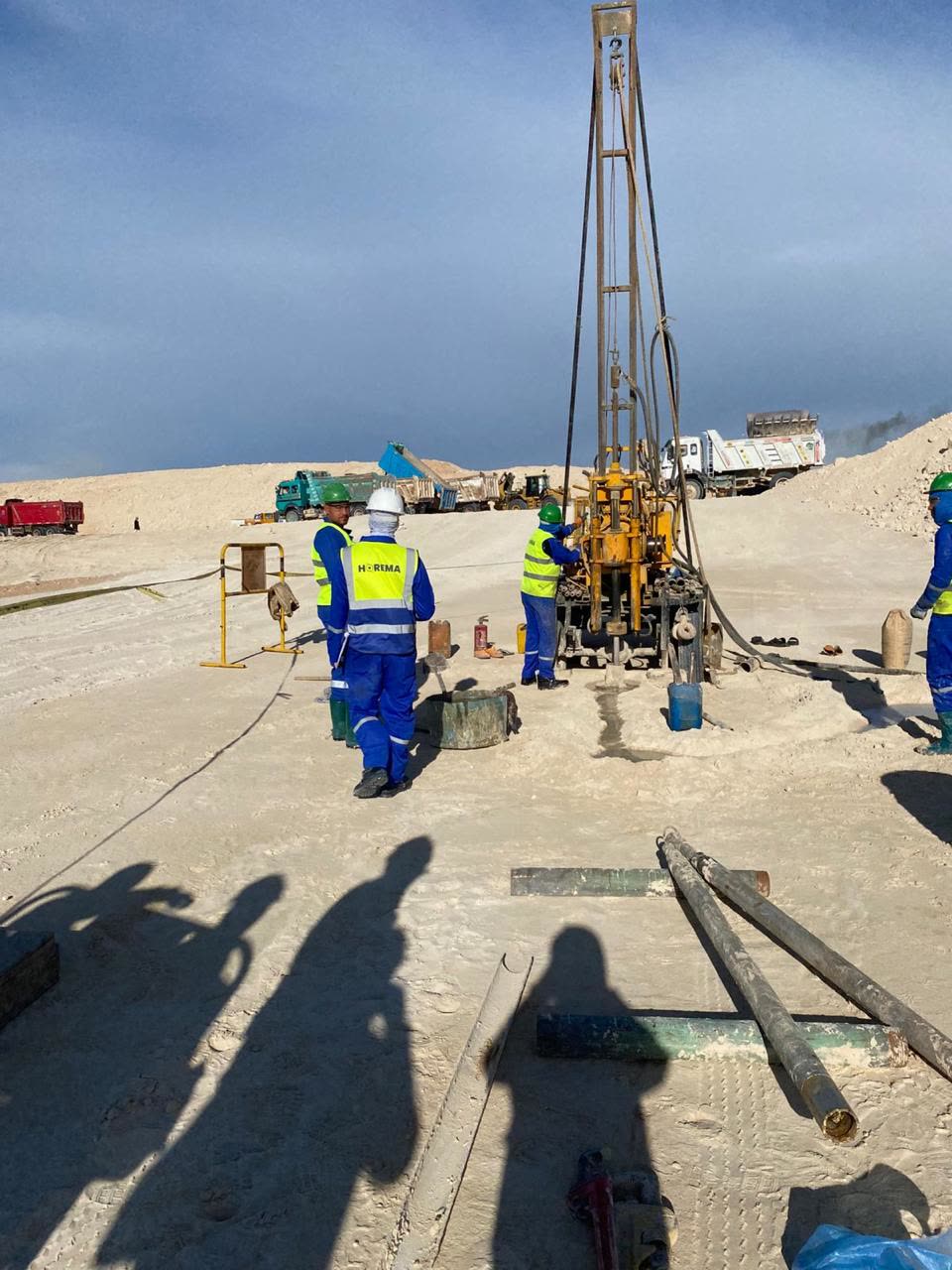
Field mobilisation
Working within live construction
Our rigs and technicians deploy into active sites — earthworks in progress, haul routes open, programmes already running. Boreholes, in-situ testing and quality control are sequenced around the contractor's works so investigation never becomes the item that holds a programme back.
Data management & digital deliverables
Field and laboratory records are managed in structured digital form. Borehole and test data can be issued in AGS format alongside conventional reports when a project calls for it.
Data deliverables
What an AGS submission looks like
AGS is a plain-text format used to exchange geotechnical data between contractors, consultants and design software. Below is a short, anonymised extract — coordinates masked — with each field explained.
"GROUP","LOCA"Group name — LOCA holds one row per borehole location"HEADING","LOCA_ID","LOCA_NATE","LOCA_NATN","LOCA_GL","LOCA_FDEP"Field names for the columns that follow"UNIT","","m","m","mOD","m"Units for each field — metres, metres above datum"DATA","BH-01","XXXXXX.XX","XXXXXX.XX","12.40","30.00"One borehole: ID, easting, northing, ground level, final depth"GROUP","ISPT"Group name — ISPT holds Standard Penetration Test results"HEADING","LOCA_ID","ISPT_TOP","ISPT_NVAL","ISPT_REP"Field names for the SPT records"UNIT","","m","",""Depth in metres; N-value is a blow count"DATA","BH-01","3.00","14","Medium dense sand"SPT at 3.00 m depth, N = 14, with the logged description
Key fields
- LOCA_ID
- Borehole or test point reference, e.g. BH-01.
- LOCA_NATE / LOCA_NATN
- Survey coordinates (easting / northing) — masked here.
- LOCA_GL
- Ground level at the hole, relative to project datum.
- LOCA_FDEP
- Final depth drilled, in metres.
- ISPT_TOP
- Depth at the top of the SPT test interval.
- ISPT_NVAL
- SPT N-value — blows per 300 mm penetration.
- ISPT_REP
- Reported soil description for that interval.
Provided alongside conventional factual and interpretative reports, where a project calls for it.